
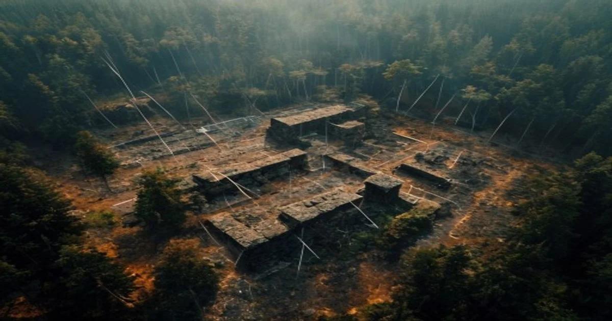
The Intersection of Tragedy and Discovery
The catastrophic increase in wildfire frequency globally has presented a grim reality for modern civilization, but it has paradoxically provided a unique opportunity for the field of archeology. As intense heat strips away dense forest canopies, previously inaccessible terrain is exposed to the sky. AI-driven wildfire archeology detection has emerged as a high-authority methodology to parse these vast, scorched landscapes for remnants of human history that have been shielded from sight for centuries.
The Role of Machine Learning in Remote Sensing
Modern archaeological surveys once required decades of boots-on-the-ground labor. Today, Machine Learning algorithms process terabytes of Lidar (Light Detection and Ranging) data in seconds. By training neural networks on known architectural signatures—such as linear walls, circular mounds, and rectangular foundation trenches—these systems can pinpoint anomalies in topography that the human eye would otherwise miss.
'The integration of high-resolution geospatial data with deep learning models has effectively turned the tide in cultural resource management,' says Dr. Elena Vance, lead researcher in digital heritage.
How the Detection Pipeline Functions
- Data Acquisition: Specialized drones or satellite platforms capture high-resolution imagery and Lidar point clouds immediately after a burn event.
- Preprocessing: Raw data is cleaned, removing noise from charred tree stumps and loose debris.
- Pattern Recognition: Trained algorithms perform binary classification, identifying pixels that deviate from natural topographical patterns.
- Verification: Human experts review the AI-flagged sites to confirm historical significance before excavation teams are deployed.
Overcoming Environmental Challenges
Wildfires create complex environmental signatures. Ash, soot, and soil composition changes can distort sensor data. However, the latest generation of AI models utilizes multi-spectral imaging to differentiate between natural geological shifts and man-made alterations. This capability is crucial, as the windows of opportunity for archaeological assessment are narrow; regrowth and erosion can reclaim these sites within a single season.
Ethical Considerations and Data Sovereignty
With the rapid deployment of this technology, the archeological community is grappling with the ethics of data access. When AI makes it easier to find sites, it also makes it easier for looters to identify potential targets. Therefore, the implementation of such systems must include robust security protocols to protect location data of vulnerable heritage sites. Innovation must be balanced with strict oversight to ensure that the findings contribute to global heritage preservation rather than exploitation.
The Future of Digital Heritage Management
As these tools evolve, we anticipate a shift from retrospective discovery to predictive protection. By analyzing environmental variables alongside historical data, AI can predict where unknown settlements might exist, allowing for proactive conservation efforts before a fire even occurs. The synergy between digital technology and human history is providing a roadmap to understanding our past with unprecedented clarity and speed.
The Need for Interdisciplinary Collaboration
It is imperative that data scientists and archaeologists work in tandem. The technical prowess of AI is only as valuable as the context provided by expert historians. By standardizing training sets and sharing open-source models, the scientific community can create a global database of anthropogenic signatures. This collaborative approach not only safeguards individual discoveries but also provides a comprehensive view of human migration and settlement patterns on a planetary scale.
Conclusion
The marriage of artificial intelligence and archeology is not merely a technological trend; it is a fundamental shift in how we interpret our collective human legacy. In the face of climate-driven disasters, these digital sentinels act as guardians of the past, ensuring that what was once hidden in the shadows of the forest is brought into the light of scientific understanding. The road ahead remains filled with challenges, but the potential for uncovering the 'lost chapters' of humanity has never been higher.